
The Grove is defined as the Brisbane suburbs of Ferny Grove, Upper Kedron, Ferny Hills, Arana Hills, Keperra, Everton Hills, Everton Park, Mitchelton, Gaythorne and Enoggera. It encompasses the natural bio-region bounded by the upper watersheds of Cedar Creek and Kedron Brook.
It is bisected by Kedron Brook which is also the local government boundary between Brisbane City Council to the south and Moreton Bay Regional council to the north.
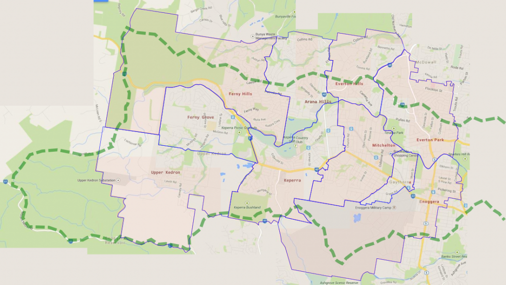
The Grove Composite Map
The heavy, green, dashed line is the catchment boundary. Suburb boundaries are in blue.
The Grove is demographically diverse with a population of approximately 30,000 and is well endowed with nature reserves, recreational facilities, schools, and retail. Ferny Grove train station is the terminus of the Ferny Grove line.
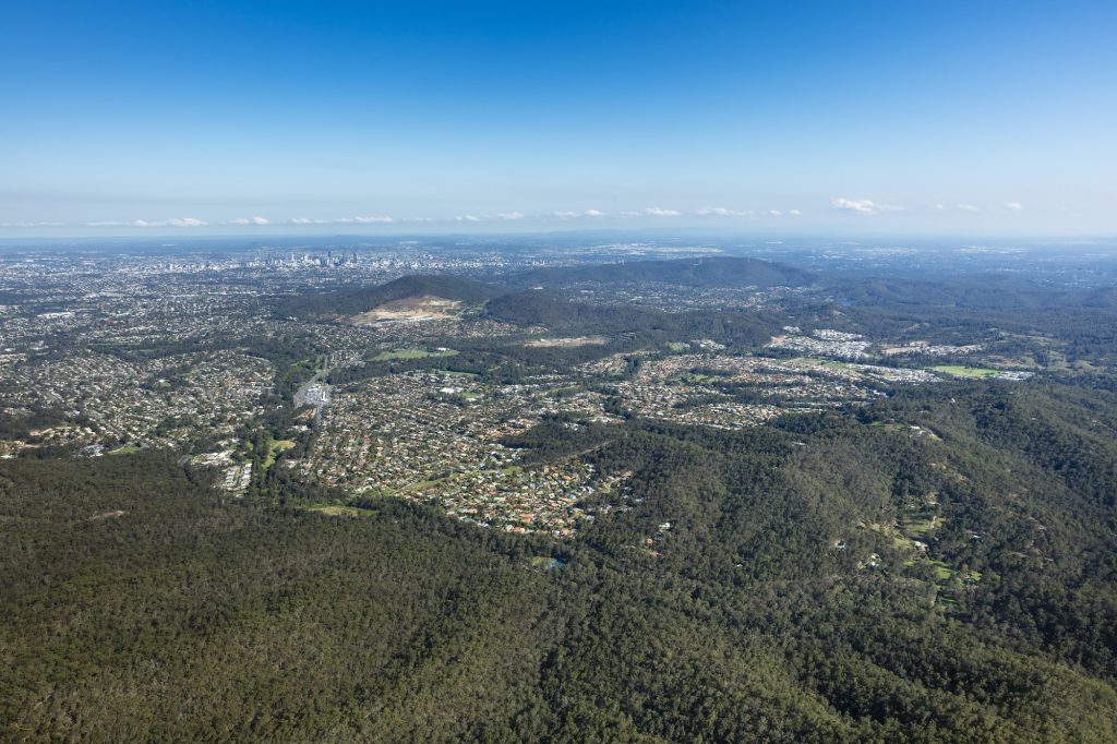
Aerial view of The Grove
This image is taken from the north-west (top left on the map above) corner of the Kedron Brook Catchment looking towards the south-east. Ferny Grove is in the centre-foreground with Ferny Grove station clearly identifiable. Upper Kedron is to the right, Ferny Hills to the left. In the middle distance is the Keperra Quarry and in the far distance Brisbane CBD.